



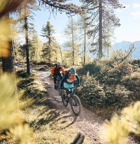


Into the Gsiesertal
Difficulty
Medium
Duration
3:00 hr./hrs.
Distance
37.9 km
Start and finish location
Hotel Laurin's ****
Uphill
730 m
Downhill
720 m
In an exciting mix of forest paths and easy trail sections, the route runs along the Gsieser stream.
The first 10 kilometres are a leisurely ride along the Val Pusteria cycle path to Monguelfo. From there, an exciting mix of forest paths and easy trail sections takes you along the Gsieser Bach stream. After another 10 kilometres, the toughest part of the tour begins, with almost 350 metres of ascent to conquer.
Plan & navigate your mountain bike route
Open the MTB route on Komoot to view the full course on the map, plan your mountain bike tour and navigate along the way. You can save the route for your personal trip planning and use or export it as a GPX file for compatible navigation devices and apps.
Into the Gsiesertal
Tour recommendation from:
Hotel Laurin's ****